For most Westport drivers, the lights on the Cribari Bridge are the main holiday attraction. But if you’re walking, check out the miniature bridge, candy cane street light and teddy bear paddling in the river below, set into the Bridge Street hillside, on the right headed to Saugatuck just before the span. It’s all strung with holiday lights too, so it must look great at night.
Some Westporters were surprised that Compo Beach was closed to swimmers yesterday.
Others were not. Heavy rains — like the ones the night before (Wednesday) — often lead to closure.
“06880” reader and environmental activist Toni Simonetti wrote: “I learned something, thanks to Mark Cooper, director of health for the Aspetuck Health District.
“Swimming is closed at town beaches for 24 hours after a very heavy rainfall (as we all witnessed into the night yesterday). Because of the excessive runoff of surface water, and all it collects along the way, it ends up in Long Island Sound.
“In Westport it takes 3 tides, or 24 hours, to cleanse the water tidally.
“The 24-hour waiting period is state protocol. Norwalk and Fairfield, on either side of Westport, have longer water cleansing times. Mark thinks that’s because we benefit from the ebbs and flows of the clean Saugatuck River.
“Just another benefit to living in Westport!”
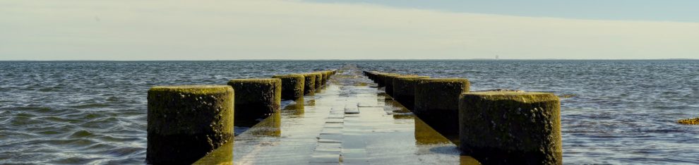
Serene. But not safe after a storm. (Photo/Sunil Hirani)
Speaking of that brief but intense storm: In addition to fouling our waters, it brought down power lines and trees.
But there were bright spots, amid the bad weather. Chris Vatis writes:
“Both Eversource line people and Gault electritians were on site within 1 1/2 hours after I reported the storm ripped both my meter and electricity pole attached to my house right off, leaving live wires all over my property.
“They worked diligently to restore it.
“I and we often complain about how much money we now pay for services. But both companies deserve praise for their excellent communication and lightning speed response to my plea for immediate help. I’m very impressed with both companies.”
=================================================
Also yesterday: No, you were not imagining things.
Traffic throughout town was worse than usual.
Way worse.
The culprit was a diesel fuel spill on I-95 southbound, between Exits 18 and 17.
As often happens, more spillage followed. Car and truck drivers got off the highway, and — in a futile attempt to move more quickly — clogged our main roads and side streets.
This Bridge Street scene was repeated at many other spots:
(Photo/Susan Garment)
=================================================
Speaking of drivers: We’re not sure how this accident occurred, but someone clipped the sign — in the middle of the traffic island at the Sherwood Island Connector, by the Post Road.
(Photo/Josh Berkowsky)
Coming from I-95, we’re now welcomed to “Estport.”
Bob Newhart — the supremely talented, always understated but very hilarious comedian who died yesterday at 94 — may not have had any connections to Westport. (Though I’m sure several commenters will note otherwise.)
But this much is certain: When he gave a speech at the Kennedy Center, upon accepting his Mark Twain Prize, he referenced a Westport icon: Paul Newman.
Click below, then fast forward to 4:13 when the story begins.
The Westport Weston Chamber of Commerce held a “Business After Hours” event last night, at the Levitt Pavilion.
Members and town officials celebrated the outdoor theater’s 50th anniversary — and the Chamber’s 93rd year.
At the Chamber of Commerce event last night (from left): Paul Lebowitz, Planning & Zoning Commission chair; RTM member Jay Keenan; 2nd Selectwoman Andrea Moore; RTM member Sal Liccione; Chamber director Matthew Mandell; 3rd Selectwoman Candice Savin; 1st Selectwoman Jen Tooker; RTM members Don O’Day and Melissa Levy. (Photo/Dan Woog
Her first novel, “The Neighbors’ Secret,” was named an American Fiction Award finalist, for pre-teen fiction.
Last year, the book was a Tassy Walden Award Finalist in 2023.
The novel takes middle school readers on “an adventure filled with puzzles, secrets, and unexpected twists,” press materials say.
“With her background as a litigation attorney and her passion for storytelling, Sussman weaves an intricate tale that keeps readers guessing until the very end.”
Diana Sussman
===========================================
Spotted lanternflies are back.
We fight them with traps and white vinegar.
But we’re not the only ones. Praying mantises are natural predators.
So — as today’s “Westport … Naturally” feature photo shows: Pray for mantises.
And finally … Dave Loggins died last week, in Nashville. He was 76.
The songwriter had only one hit of his own: “Please Come to Boston.” But he wrote songs for many other artists, including Willie Nelson, Tanya Tucker, Wynonna Judd and Toby Keith.
Non-country music fans knew him too. He wrote the Masters golf tournament theme, a staple of spring sports telecasts for over 40 years. Click here for a full obituary.
(Whether you’re from Westport — or Boston, Denver, LA or anywhere else — if you enjoy “06880,” please click here to support our work. Thank you!)
From 3,500 feet, in a 3-seat prop plane, I got a remarkable view of our town.
I marveled at the amount of water. The compactness of downtown and Saugatuck. And the many, many trees that provided a canopy, nearly everywhere.
In 1934, a statewide project photographed every square inch of the state.
The images are housed at the University of Connecticut. They’re fascinating.
Fred Cantor found this shot of Westport:
Click on or hover over to enlarge.
Amonghe surprises, he writes, are “how many houses there were by that point in the Compo Beach neighborhood (bottom center of the photo), and the fairly large number of houses in the Compo Hill/Old Mill Beach neighborhood (just above it).
“I imagine most of these were probably not winterized, but still…”
However, Fred adds, “I expected to see more homes directly on South Compo Road, leading from the train tracks to the beach.”
Also of note: The crooked intersection of South Compo, Bridge Street and Greens Farms Road (just above the railroad tracks). It looked a bit different, before I-95 was built 2 decades later.
What do you notice? Click “Comments” below to share your observations.
(Friday Flashback is a weekly feature on “06880.” Please click here to support it — and this entire hyper-local blog. Thank you!)
Westport does not lack for old, Federal-style homes, with handsome features like cupolas and widow’s walks. (Though, like many venerable houses in Westport, they are an endangered species.)
So it’s particularly impressive that 17 readers quickly knew exactly where last week’s Photo Challenge — portraying just the top of the home — was.
Peter Barlow’s well-cropped photo (click here to see) showed 16 Bridge Street, next to Saxon Lane near Imperial Avenue.
It’s a well-traveled road. When back-ups occur — as they frequently do — at least drivers have a wonderful streetscape to occupy their time.
(And despite recent new construction, Bridge Street is now part of a Historic District.)
Fred Cantor, Seth Schachter, Doug Weber (who should know — he owns the home!), Andrea Cross, Dave Eason, Jonathan McClure, Andrew Colabella, Diane Silfen, Michelle and Steven Saunders, Werner Liepolt (who lives across the street), Nina Marino, Clark Thiemann, Jo Kirsch, Adam Starr, Shirlee Gordon, Bill Scheffler and Mary Ann Batsell all knew their architecture. Congratulations!
As for that widow’s walk: A kerfuffle broke out in the Comments section when a reader claimed the term referred only to those on homes in whaling communities. That’s not true. Any coastal house can have a widow’s walk.
However, the definition of that feature refers to a “railed rooftop platform” where women could stare out to sea, waiting for their husband’s ship to come in.
16 Bridge Street does not have that raised platform — it’s all enclosed (though perhaps it once did). The debate continues.
Today’s Photo Challenge is a bit tougher. If you know where in Westport you’d see this, click “Comments” below.
(Photo/Scott Smith)
(If you enjoy this Sunday feature, please consider a contribution to “06880.” Click here — and thank you!)
During COVID, Westport’s eerily empty streets were a joy to drive.
A sad joy, to be sure. The other side of our unimpeded ride was knowing that so many friends and neighbors were stuck home, inside, with nowhere at all to go.
Now — thanks to vaccinations, warm weather and pandemic fatigue — traffic is back.
And it’s worse than ever.
For hours a day, backups stretch everywhere: from Route 1 and 33 almost to Fresh Market. Canal and Main Streets. All of Saugatuck.
No one can say for sure why it’s this bad. But driving in Westport really, really sucks.
Waiting in line at the Imperial Avenue light. (Photo/Dick Lowenstein)
With time on my hands the other day — I wasn’t going anywhere — I tried to think of solutions.
I wouldn’t wish another townwide quarantine on anyone. Banning Waze is not an option. (I’m as hypocritical as the rest of Westport: I happily use the app to avoid highway traffic by driving through other towns.)
So I did the next best thing. I came up with a few ideas.
For example:
Alternate red and green lights at both Wilton Road and Riverside Avenue. The awkward dance between cars heading northbound and southbound doesn’t work. One car trying to turn left from Wilton Road onto the Post Road — or left from Riverside onto Post Road West — can hold up a dozen cars behind it. So why not have green for only northbound traffic; then only green for southbound traffic; followed by what we’ve got now (first a “left turn only” for eastbound and westbound drivers, then a full green for both).
What’s the holdup? Some dude at the front of this line, trying to turn left onto the Post Road. (Photo/David Waldman)
Add a “left turn only” for drivers on South Compo, going westbound on Bridge Street. Traffic now routinely backs up under the railroad bridge.
At the same time, change the timing of the light. It’s too long for Greens Farms Road and Bridge Street drivers, not long enough for those on Compo South. (I know; a long light helps ease traffic on Greens Farms and Bridge Street when it’s backed up with I-95 overflow. Maybe shorter lights would effect Waze’s algorithm of suggesting that as an alternate route.)
A “left-turn only” arrow from South Compo to Bridge Street will make traffic flow as easily as it appears in this image from Google Maps.
Reconfigure the turning lane from Kings Highway North (where the Willows/ “Fort Apache” medical complex is on the right), onto Wilton Road. Right now the right lane is for right turns and cars going straight on Kings Highway. When one car in that lane heads straight, no one behind can turn right on red. Make the left lane for left turns and straight ahead; the right lane should be “right on red” only.
Another reason Kings Highway North should be “right turn on red” only: The left lane lines up more directly with its continuation past Wilton Road.
All of these ideas are beyond the scope of Westport officials. They’re state roads. So yeah, I know, I have a better chance of walking to the planet Zork than I do of seeing meaningful traffic light changes.
But a boy can dream.
(Do you have an idea for easing Westport’s traffic woes? Click “Comments” below. It won’t do any good — but at least “06880” readers can appreciate your brilliance.)
Around the corner is the William F. Cribari Bridge. In 1987 — the first time the century-old span was slated to be replaced by a modern one — Westporters succeeded in gaining National Historic Structure designation for it.
The William Cribari (Bridge Street) Bridge is the gateway to Bridge Street. (Photo/Fred Cantor)
In November 2015 — with plans once again afoot to renovate or replace the Cribari Bridge, and spillover impacts likely for Bridge Street and beyond — Liepolt began a quest to get National Historic District status for his entire neighborhood.
The longtime Westporter knew that many of the houses on his road had contributed to Westport history. Over the years, he’d heard stories from older residents about who grew up where, which families were related, and how beautifully the forsythia had bloomed.
He saw historical plaques affixed to many homes. But to submit a Historic District application, he needed to learn more.
Morley Boyd — Westport’s historic preservation expert — directed Liepolt to a history of the town, and an 1869 document in which Chloe Allen “dedicated to the public” the road between her house (still standing on the corner of Bridge Street and South Compo) and the Saugatuck River.
Chloe Allen lived in the Delancy Allen House at 192 Compo Road South. It was built in 1809.
That half-mile stretch now boasts more than 20 historical resources. Thirty-one properties are eligible for Connecticut State Historic Preservation plaques.
Wendy Crowther noted that a New Yorker cover by Edna Eicke shows a little girl celebrating July 4th on the porch of her 1880 home, on the corner of Imperial Avenue and Bridge Street.
That’s the same house where John Dolan — keeper of the manually operated swing bridge — lived until the 1940s.
The New Yorker cover of June 30, 1956 shows this 1880 home, at the corner of Bridge Street and Imperial Avenue.
Liepolt also researched what it means to be a National Register District. Benefits, he found, are modest — and obligations non-existent.
A homeowner can do anything to and with a house that any other owner can. An owner who makes restorational repairs may enjoy a tax benefit.
Liepolt learned too that if any federal funding, licensing or permitting is involved in development in a National Register District, that agency must take into account the effects of that action on historic properties, and consult with stakeholders.
Liepolt says this means that a possible Connecticut Department of Transportation plan to use federal funds to widen Route 136 — Bridge Street — as it feeds the bridge over the Saugatuck would require the Federal Highway Authority to consider the effect, and consult with property owners there.
The 1884 Rufus Wakeman House, at 18 Bridge Street.
The goal of this consultation is to mitigate “adverse effects,” Liepolt explains. These can be direct or indirect, and include physical destruction and damage; alteration inconsistent with standards for the treatment of historic properties; relocation of the property; change in the character of the property’s use; introduction of incompatible elements; neglect and deterioration, and more.
In February 2016, Liepolt asked Westport’s Historic District Commission to make a formal request for designation of the Bridge Street neighborhood. It was approved unanimously.
Liepolt worked with HDC coordinator Carol Leahy and an architectural historian to complete the research, take photographs, compile materials and write the final application to the National Parks Service.
The 1886 Orlando Allen House, at 24 Bridge Street.
This past April, the application was approved. Bridge Street is now added to the list of Nationally Registered Districts.
There was no big announcement. I’m not sure if anyone in town really noticed.
But we sure would notice if — without this designation — the look and character of the Bridge Street neighborhood ever changed.
Due to electrical grid damage from Friday’s storm, and continuing repairs, it is anticipated that the intersection of Greens Farms Road/Bridge Street at Compo Road South may remain closed to traffic at least through the morning commute tomorrow (Monday, March 5).
No traffic will be allowed through the intersection of Greens Farms Road at Compo Road South.
Road closures will be in place at Bridge Street at Imperial Avenue, Compo Road South at Keyser Road, Greens Farms Road at Hillspoint Road, and Compo Road South at Elaine Road. Any destinations within this area will be accessible only to local traffic; all other traffic should must use detours.
Drivers traveling from all points south of the I-95 overpass on Compo Road South should follow Compo Road South to Hillspoint Road north to the intersection of Greens Farms Road. From this point, traffic will be routed either east on Greens Farms Road and/or north on Hillspoint Road.
Drivers traveling west on Greens Farms Road will be detoured north at the intersection of Greens Farms Road and Hillspoint Road toward Post Road East.
No westbound traffic will be allowed on to Greens Farms Road from the Sherwood Island Connector. This area will be accessible to local traffic only. All other traffic will be diverted north on the Sherwood Island Connector towards Post Road East.
Compo Road South will be completely closed to southbound traffic at the intersection with Keyser Road.
All southbound traffic on Imperial Avenue will be diverted west on Bridge Street. All eastbound traffic on Bridge Street will be diverted north on to Imperial Avenue.
It’s one of the most well-known houses in Westport.
But it won’t be for long.
The small yellow cottage on Bridge Street — the first one past the William Cribari Bridge heading east — sports a “Demolition” notice on a nearby tree.
On Friday, “06880” posted a story on a citizens’ campaign to install mobile speed signs — “traffic calming devices” — on Imperial Avenue and Bridge Street.
The GoFundMe drive had already garnered $1975 in pledges. The goal was $10,000 — by December 31.
Today — just 72 hours later, and nearly 60 days ahead of schedule — that figure has been reached. (And more: As of this morning it was up to $10,100.)
Nicole Dodge — one of the organizers — says:
This issues clearly resonates with residents of our neighborhood. It’s the first step towards addressing the issue of excessive speed on Imperial and Bridge Street and the surrounding areas. We are pleased we were able to raise the money so quickly, so we can move forward in further addressing this problem and prioritizing pedestrian safety.
Well done, Gang of 6 who came up with the campaign.
And well done, “06880” readers. You rock!
Now please be sure to slow down on Imperial Avenue, Bridge Street — and everywhere else in town!
We’ve all seen them: The solar-paneled radar signs that give the speed limit on a particular stretch of road, then flash your speed. It’s always faster than the speed limit, of course, and you always slow down.
A typical mobile speed sign.
Studies show significant decreases in vehicle speeds on streets that use them. But they’re mobile, so they pop up in different places at different times.
There is no funding in the town budget to purchase these “traffic calming speed signs.” But 6 Westporters have begun a GoFundMe campaign to buy 2 more. They’ll be placed — permanently — on Imperial Avenue and Bridge Street.
The citizens — Matt Heisler, Karen Jacobs, Nicole Dodge, Jennifer Johnson, Andrea Moore and Al DiGuido — are spurred by the fact that in the last 6 months, 2 neighbors have been hit by cars while jogging.
The Police Department is partnering with the group. They’ll assume responsibility for installation and maintenance of the signs — and will monitor all speed data.
Each device costs almost $5,000. The GoFundMe goal is $10,000. It runs through December 31. If the total amount is not reached, no money will be collected.
As of this morning, $1,975 had been pledged.
“This is where we live,” the group says. “This is where our kids go to school. This is where we walk, run, bike and drive.”
Of course, they’ll accept contributions from anyone in Westport — and beyond.
(For more information, or to contribute, click here.)
Click here to help support “06880” via credit card or PayPal. Any amount is welcome, appreciated — and tax-deductible! Reader contributions keep this blog going. (Alternate methods: Please send a check to “06880”: PO Box 744, Westport, CT 06881. Or use Venmo: @blog06880. Or Zelle: danwoog@gmail.com. Thanks!)
GET THE “06880” APP
The “06880” app (search for it on the Apple or Android store) is the easiest way to get “06880.” Choose notifications: whenever a new post is published, or once or twice a day. Click here for details.