
Compo Beach yesterday morning … (Photo/Tracy Porosoff)

… and evening … (Photo/Les Dinkin)

… plus the sunset on Saugatuck Shores … (Photo/Jeff Manchester)

… and another view, from Grace Salmon Park. (Photo/Sam Levenson)
Compo Beach yesterday morning … (Photo/Tracy Porosoff)
… and evening … (Photo/Les Dinkin)
… plus the sunset on Saugatuck Shores … (Photo/Jeff Manchester)
… and another view, from Grace Salmon Park. (Photo/Sam Levenson)
Posted in Beach, Downtown, Pic of the Day
Tagged Compo Beach, Grace Salmon Park, Saugatuck Shores

It’s been a while since we checked in on the Fresh Market ospreys. Looks like they’re doing great! (Photo/Johanna Rossi)

Meanwhile, there’s plenty of other wildlife to admire. Like many Westporters, this guy is enjoying a fine dinner. (Photo/Johanna Rossi)

That’s MISTER Wild Turkey to you. (Photo/Johanna Rossi)

Cute, unless she’s eating your plants. (Photo/Johanna Rossi)

A yellow-crowned night heron enjoys a meal on Saugatuck Shores (Photo/Gene Borio)
Posted in Environment, Pic of the Day
Tagged Deer, ospreys, Saugatuck Shores, wild turkey
You don’t get more “Westport” than last week’s Photo Challenge.
Michael Tomashefsky’s image showed rocks, a jetty and water. It’s a scene we see all over town — from Frost Point on Beachside Avenue and nearby Burying Hill Beach, to Sherwood Island, Schlaet’s Point and Compo.
Those were some of the guesses. Others ranged further afield: Cockenoe, and Canfield/Sprite Island. John McCarthy was somewhat correct, but not quite precise enough, when he suggested “somewhere near the water.”
The first winner was Diane Silfen. She knew that this photo was taken at the end of Canal Road, off Saugatuck Shores. That’s a part of Westport that many residents may not be familiar with.
But — like so many other spots in town — it offers stunning, and ever-changing, water views. (Click here for the photo, and all the guesses.)
Caitlin Engle checked in later, calling it one of Westport’s “hidden gems.”
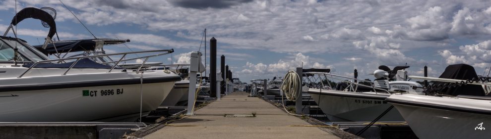
There’s a bit of water in this week’s Photo Challenge too. If you know where in Westport you’d find this, click “Comments” below.

(Photo/Dave Wilson)
It’s been over 4 months since a nor’easter caused Chipper B to break from its mooring.
It washed up on the shores of Saugatuck Shores. It’s been there ever since.
Today, neighbors were pleased to see heavy equipment surround the vessel.

(Photo/Jeff Manchester)
It’s not clear what’s happening, or whether the machines belong to the town or an insurance company.
But — to the relief of many residents — Chipper B may soon have a new home.
Saugatuck Shores has been in the news recently.
A new bridge turned out nicely. New guardrails nearby did not.
For months, a boat has been beached just off Harbor Road.
And whenever there’s an astronomical high tide or just a bigger-than-usual weather event, the area floods.
Saugatuck Shores is one of Westport’s most coveted neighborhoods — with real estate prices to match.
That status has come recently. For decades it was a just funky, quirky beachside community.
And — as this 1963 aerial photo shows — there was plenty of room to build.


Ignoring a “No Parking” sign on Saugatuck Shores (Photo/Lou Mall)
Chipper B has a new resting spot.
Last weekend’s nor’easter blew the abandoned vessel closer to Saugatuck Shores.
At low tide, this is what it looks like.

(Photo/JP Vellotti)

Today’s nor’easter caused havoc throughout Westport. This was the scene at Burying Hill Beach. (Photo/Nico Eisenberger)

The wind and full moon whipped the water all the way to the Compo Beach parking lot. (Photo/Ian Warburg)

Water rose nearly to the top of the Sherwood Mill Pond tidal gates. (Photo/Robin Tauck)

Today’s nor’easter damaged this 1915 Compo Cove house. It’s weathered many previous ones too. (Photo/Robin Tauck)

On the other side of the Mill Pond, waves lashed Old Mill Beach at Compo Cove. (Photo/Robin Tauck)

A flooded yard at Old Mill Beach … (Photo/Matt Murray)

… and, behind Old Mill, the garage for Compo Cove residents was under water. (Photo/Matt Murray)

A backyard on Stony Point Road. It’s behind the high wall near the train station eastbound parking lot, by the Saugatuck River. (Photo/Richard Jaffe)

Today’s storm brought the Chipper B — the abandoned vessel near Saugatuck Harbor Yacht Club — another 10 feet closer to shore. (Photo/Jennifer Seymour)
Posted in Beach, Pic of the Day, Weather
Tagged Burying Hill Beach, Compo Cove, Old Mill Beach, Saugatuck Shores, Sherwood Mill Pond tidal gates
Saugatuck Shores was hit hardest by today’s near-nor’easter. Jennifer Seymour reports:
2 hours after high tide, there was still several feet of water. My husband rescued me and my sons by kayak on the island side of the Saugatuck Island bridge. I lived here during Irene and Sandy, and have seen nothing close since then.

With Saugatuck Shores flooded, Jennifer Seymour’s husband and daughter paddle a kayak.

One view of Saugatuck Shores …

… and another. Yes, that’s a road. (Saugatuck Shores photos/Jennifer Seymour)

Longshore’s ER Strait Marina …

… and nearby Evan Harding Point. (Longshore photos/Scott Smith)

The Soundview Drive seawall took a pounding … (Photo/Andrew Colabella)

… but it doesn’t faze Soundview resident Paul Lane. He’s lived there for decades, and weathered many storms. (Photo/Betsy P. Kahn)

An old standby: the Compo cannons. (Photo/Andrew Colabella)

Quentin Road, off Compo Beach Road. (Photo/Bruce Becker)

Grove Point Road was underwater too. (Photo/Andrew Colabella)
Posted in Beach, Longshore, Weather
Tagged Compo Beach cannons, ER Strait Marina, Grove Point Road, Quentin Road, Saugatuck Shores, Soundview Drive
The new bridge to Saugatuck Island has gotten lots of press (and praise).
But area residents are less pleased about another project on Saugatuck Shores.
Gene Borio reports on a culvert replacement project that has closed off Canal Road since earlier this month.
“Somehow,” he says, “the construction company missed out on the idea that if they completely close off ingress and egress of seawater to the pond for 2 months of estimated work, the pond might stagnate and start dying.”

(Photo/Gene Borio)
When 3 eels floated to the surface, neighbors called the town. An emergency culvert was quickly installed.
But, Gene says, “the eels were so bad, even a gull wouldn’t eat them.”

This gull tried — and rejected — this eel, photographer Gene Borio says.
He adds, “It’s definitely affecting life around here. Even on weekends, people think they can’t cross to get to the beach.”
They can, he says — if they don’t mind mud and obstructions.
Still, drivers constantly see a sign saying the bridge is closed, and turn around.
Saugatuck Shores resident Jeff Manchester is also concerned. Hundreds — perhaps thousands — of cars, oil trucks, boats and trailers and school buses have backed down Canal Road, he says.

One of the many trucks that now backs down Canal Road. (Photo/Jeff Manchester)
They’re following confusing signs that should instead divert Canal Road traffic over the bridge on Harbor Road.

(Photo/Jeff Manchester)
He recommends a simple solution: replace the “Bridge Closed” sign with the one used when the bridge was being renovated.
Otherwise, he warns, “we’ll see a vehicle in the canal.”
Posted in Environment, Transportation
Tagged Canal Road, Harbor Road, Saugatuck Island, Saugatuck Shores

Click here to help support “06880” via credit card or PayPal. Any amount is welcome, appreciated — and tax-deductible! Reader contributions keep this blog going. (Alternate methods: Please send a check to “06880”: PO Box 744, Westport, CT 06881. Or use Venmo: @blog06880. Or Zelle: dwoog@optonline.net. Thanks!)