Scott Smith has introduced “06880” readers to some of Westport’s most hidden treasures (including, most notably, Haskins Preserve).
Today, he shines a light on another. Scott writes:
There’s an under-the-radar patch of open space in Westport that I suspect few people know about: the Eno Marsh Preserve.
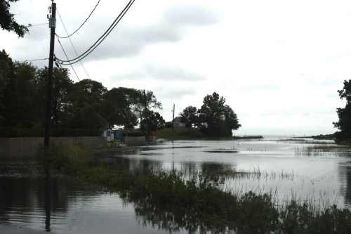
Tucked into the southwest corner of town, it’s a mix of wetlands and woods shoe-horned in behind some homes and condos, the railroad tracks. and more swampland that extends to the Norwalk border.

A short walking trail that winds through the parcel is accessible from the far end of daily-fee parking lot #4, off Saugatuck Avenue, with another entrance at the end of a private road next to the handsome brick building farther down Route 136 that originally housed the offices of William Phelps Eno.
Managed by the Aspetuck Land Trust, the pocket preserve is named for the local man considered the “father of traffic safety.” A New York trust fund baby of the gilded age, Eno devoted his life to bringing order to the newfangled world of automotive transport in the early part of the 20th century.
He’s credited with the invention of the stop sign, pedestrian crosswalk and traffic circle, among other innovations. The transportation institute he founded survives to this day, in Washington. (Click here for his fascinating Wikipedia entry.)

The former Eno Foundation building, on Saugatuck Avenue.
Here in Westport Eno owned a 32-room mansion on the Saugatuck River, across from his offices; I suppose part of his original estate extended to the wetlands out back. Though the office building survives, the circa-1877, 15,000-square foot mansion known as Judah Rock was demolished in 1997, after a failed preservation effort.
The Preserve’s location is obscure, and some wouldn’t consider it even all that scenic. In fact, its most noticeable view may well be of the big new apartment complex rising across the train tracks on Hiawatha Lane.

View from Eno Marsh Preserve, of the Hiawatha Lane apartments.
But what the short, brambly trail does have are several of the tallest trees in town — including 3 or more magnificent tulip poplars that soar on thick trunks to spread their branches into the sky. You can see these trees on a Google satellite map view of the preserve.

Eno Marsh Preserve tulip poplars.
The site clearly doesn’t get as much love — or foot traffic — as some of the other Aspetuck Land Trust properties in town, among them the lovely Caryl & Edna Haskins Preserve, the expansive Newman-Poses Preserve, and the Leonard Schine Preserve, with its marked trails and children’s playscape.
Perhaps that’s as it should be; not all open spaces need to be popular. I’m sure the wood ducks and deer in this empty quarter of Westport cherish their privacy.
But I treasure its existence, and trust the preserve can be maintained as a public resource — not just for its natural beauty, but also as a reminder of a time when the privileged among us left real-life legacies to enjoy, and to remember them for long after they are gone.

Eno Marsh Preserve. (All photos/Scott Smith)
(“06880” covers the waterfront — and every other part of town too. If you enjoy stories like these, please click here to support our work. Thank you!)