As a longtime Bridge Street resident, Werner Liepolt has a front-porch view of traffic — including the vehicles that apps like Waze send past his house. He writes:
Take a look at Westport the way a navigation algorithm does.

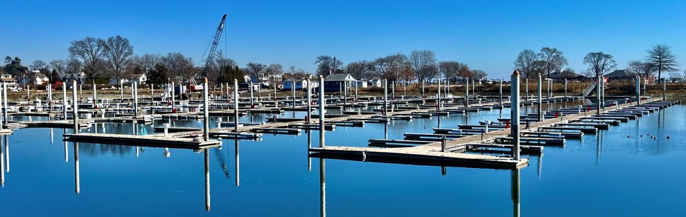
I-95: Thursday, March 26, 9 p.m.
It sees not a collection of neighborhoods — but a network.
Because that’s how today’s traffic actually moves.
From the Waze-eye view, the logic is clear. Waze sees traffic speed and volume, but it doesn’t reliably see or respect local rules and human factors that shape safe and appropriate traffic patterns.
Waze emojis and avatars — “Moods” — represent “Wazers:” happy, fast, or stuck in traffic. Other icons indicate real-time reports, crashes, hazards and police.
Waze does not consistently indicate local thru-truck prohibitions. Neither school bus stops nor routes are accounted for. Ditto cyclists, crosswalks and pedestrian activity.
And Waze of course has no way of measuring or reporting long time and cumulative effects of traffic noise, pollution, aesthetic impact or vibration damage.
Waze also ignores narrow streets and historic districts — for example, the Bridge Street National Register Historic District.
The Cribari Bridge is not isolated. It connects directly to a sequence of roads that carry traffic eastward through Westport.
From the Waze eye view, the logic is clear.

The William F. Cribari Memorial Bridge connects Riverside Avenue’s commercial district directly to Bridge Street (Route 136), feeding traffic into a residential corridor that continues inland. What appears to be a local crossing is, in fact, a key link in a broader east–west route.
Now look a few miles away.
Individually, these are routine infrastructure projects.
Together, they form something much more consequential.
Just east of Westport, the Sasco Creek Bridge sits on Greens Farms Road near the Post Road and I-95 Exit 19. The Connecticut Department of Transportation proposes removing a major constraint at the eastern end of the same corridor.

CTDOT is:
- Likely increasing load capacity at Sasco Creek. The design drawings show a full-capacity structure capable of carrying legal truck traffic.
- Removing geometric constraints and increasing load capacity at the Cribari Bridge, making it capable of handling legal truck traffic.
Yet the Environmental Assessment of the Cribari Bridge assumes trucks will not use this route — without analyzing what happens once both bridges in this corridor are upgraded,
That creates a continuous, higher-capacity east-west route from Fairfield on the Old Kings Highway through Westport on Greens Farms Road and Bridge Street to Saugatuck — closely paralleling I-95 between Exits 18 and 19.
This is not speculation. It is visible on the map. The Sasco Bridge CTDOT Project 0158-0218 is already underway. The hearings concluded in 2021.
They concluded about the time the Environmental Assessment for CTDOT project 0158-0214 (the Cribari Bridge) was being written. Now the hearings and time for public comment on that project will end on April 17.
Combined, these CTDOT projects should broaden the Cribari Bridge Area of Potential Effect to the entire I-95-Greens Farms Road corridor.
Navigation apps do not consider whether a road is “appropriate” for through traffic.
They calculate the fastest route.

When I-95 backs up — as it often does — these systems will route drivers off the highway, send them across Sasco Creek, through Greens Farms and Bridge Street, over the Cribari Bridge, and back toward the highway or local destinations.
Once weight limits and geometric constraints are removed, this corridor becomes accessible, continuous, and visible to routing algorithms.
At that point, it will be used.
The Environmental Assessment for the Cribari Bridge suggests that trucks and through-traffic will not find this route “desirable.”
![]() But that assumption belongs to an earlier era.
But that assumption belongs to an earlier era.
Today, traffic patterns are shaped not just by drivers, but by software. And software does not share local sensibilities.
Nowhere does the Environmental Assessment meaningfully examine:
- The combined effect of upgrading both bridges
- Diversion from I-95 during congestion
- The role of real-time navigation systems
- Impacts on residential streets and safety
Instead, the project is evaluated as if each bridge exists in isolation. It does not.
If this corridor begins to function as an alternative to I-95, the consequences will be felt across Westport:
- Increased traffic through residential neighborhoods
- Safety concerns for pedestrians and cyclists
- Noise and air quality impacts
- Changes to the character of a federally recognized historic district
These are precisely the kinds of indirect and cumulative effects that federal law requires agencies to consider.
No complex modeling is needed to understand the risk. The map already shows:
- A connected route
- Fewer constraints
- A faster alternative to a congested highway
- Numerous Waze alternative routes from the Post Rd and through residential neighborhoods south of the Post Road
The question is not whether traffic will use the corridor. The question is why the state has not fully evaluated that possibility.
![]() Public comment on the Cribari Bridge project is open through April 17. Submitted comments make a difference and must be counted under FHWA regulations. Comments can be submitted here or by voicemail: (860) 594-2020. (reference State Project No. 0158-0214). Written comments can be mailed to: James Barrows, 2800 Berlin Turnpike, P.O. Box 317546, Newington CT 06131-7546.
Public comment on the Cribari Bridge project is open through April 17. Submitted comments make a difference and must be counted under FHWA regulations. Comments can be submitted here or by voicemail: (860) 594-2020. (reference State Project No. 0158-0214). Written comments can be mailed to: James Barrows, 2800 Berlin Turnpike, P.O. Box 317546, Newington CT 06131-7546.
(Our “Opinion” pages are open to all. Email submissions to 06880blog@gmail.com. To support our work, please click here. Thank you!)

The answer to the question “why the state has not fully evaluated that possibility?” is simply that the state does not give a shit about neighborhoods so long as they have met MINIMUM safety requirements that can avoid law suits.
REGARDLESS of protestations to the contrary.
I go back in Westport, as a child, when we called the Cribari Bridge Peter’s Bridge. These concerns are decades old.
I think it is time for the State (Ned Lamont) and the Feds to bring in altogether different traffic engineers. If we look at China for a possible guide, they would have widened 95 to 10-11 lanes from 6, or double decked it.
It is time to solve the problems of 95’s intense congestion not by ruining all the many local Connecticut and Westchester towns, but by reaching back to the type of bold American thinking that brought us the interstate highway system in the first place.
We all appear to forget that Governments used to solve our people’s problems rather than compound them.
Waze is an example of something whose usefulness diminishes the more people use it. This also tends to “ping-pong” traffic flows between two alternatives as the Waze route clogs up and the Waze-less-favored route clears up. I use it in conjunction with other routing apps, but very often choose “anti-Waze” routing.
My on the ground assessment is that this corridor already functions as an alternate to I95 whenever it has an extreme backup. A commuter who parks in the lot on the far side of the train tracks faces an impossible task to get back to their home in Westport. Drivers exiting I95 block the intersections , ignore red lights and create a significant issue for this section of our town. I have sent the First Select Woman a detailed letter about the problem. Nothing has been done.
A number of thoughtful observations here—from how routing apps behave, to what people are already experiencing on the ground. I encourage posting on the Cribari Bridge project page so your comments become part of the federal record.
What’s striking is that several comments point to the same underlying issue: this corridor already functions, at times, as an alternative to I-95, and navigation apps can amplify that behavior in real time.
My concern isn’t about intent, or even about broader highway policy. It’s whether the Environmental Assessment fully evaluates these kinds of indirect and cumulative effects—including the combined impact of nearby bridge changes that would allow all legal truck traffic, and how modern routing systems can redirect vehicles through residential neighborhoods at peak times, such as school bus pickup, commuter traffic, etc.
That’s something federal review is specifically intended to address, and why I submitted a formal comment with maps and documentation for the record.
Having lived just off Greens Farms Road for more than 20 years and before that, off Imperial Ave., I know full well the congestion that often plagues this part of Westport. In fact, for years I rode my bike the mile or so across the bridge to the train station to get to work without the traffic hassle. Still, there’s no place I’d rather live. So allow me to ask a question I never hear discussed in this debate: To what extent is it our ethical or moral responsibility to accept the fact that drivers will on occasion need to use our local thoroughfares to avoid an accident or construction delay on 95? These people pay federal and state taxes, same as we do. Like us, they have kids to get home to, a doctor’s appointment to make, work to get done. I bet few Westporters think twice about using Waze or another app to get around traffic backups in other communities. What entitles us to think that our public roads are not for others to use?
Trucks heading into Saugatuck get Trapped, either at the U-turn at Riverside and Saugatuck or under the Metro-North bridge on Saugatuck Ave, which bears plenty of scars from past impacts. The right turn past Rinkos, hoping to return under I-95, holds a hazard called high centering- expensive to say the least.
Today, although posted 12’7″ -the Cribari bridges clearance is in fact 13’10”, allowing a lost truck to pass without impacts. But imagine if CONDOT built a span to 12’7″ and a tired, lost trucker slammed 40 tons into a movable span at 20+ mph. No doubt we would have a bigger problem than if it was a fixed span.
Modern trucking uses commercial apps- not Waze- Brokers give drivers planned routes as they make money based on consistent pick-up and delivery times.
The only options are roll the dice with a “Band Aid” of the old bridge and get 15+ additional years or embrace the full replacement and get in early with CONDOT for aspects we can have input on.
The comment period is great, but instead of commenting with half the info, ask good questions and ideas, they will answer everyone.
I live on Riverside Ave close to the post road. When my daughter commuted home from New Haven, I would head to greens farm station to get here to avoid traffic from the saugatuck station. It was a peaceful ride there and back, even though further. just a share.
Thank you for your thoughtful overview. Can you expand on how Sasco Creek Bridge becomes a thoroughfare for I-95 alternative traffic? First, that bridge rehabilitation project was completed in December of 2025. Second (and more importantly), why would traffic be re-routed from Green Farms to the Sasco Creek when they can just use the Post Road? Greens Farms (via Kings Hwy) literally ends right at the entrance of Exit 19. I can’t see taking the journey from Buckley to Old Road to Wakeman to Hulls Hwy to Post Road as a shortcut. I think you are trying to link these 2 bridge projects (Sasco Creek & Cribari) where there really isn’t any connection.
Thanks for the thoughtful question. The point isn’t that every driver would take a single continuous route exactly as mapped, but that removing constraints at both ends of the corridor makes a wider range of east–west alternatives more viable and more visible to routing systems during congestion.
In practice, these systems don’t rely on one fixed path—they distribute traffic across multiple parallel local routes depending on conditions. The concern is whether the combined effect of these changes has been fully evaluated, rather than whether any single route becomes dominant.
From a day-to-day standpoint, Greens Farms Road already carries significant I-95 diversion traffic during peak periods, which underscores why understanding these network effects matters.
Navigation apps do rely on their algorithms, however, anyone with a map can also find the same route when there is a crash impeding traffic on I-95. It takes a little more work but many of my personal “shortcuts” were developed by checking a map. There is more complexity to this issue than the use of Waze – think about the poor or dangerous drivers on I-95 who create the very problems that cause others to exit the highway for surface routes. More enforcement and smarter driving (better drivers ed to begin with?) would be helpful although that feels like pie in the sky.
When we moved to Fairfield, I of course immediately got a fully in person job in Darien, so I did the dreaded commute down I-95.
Occasionally I’d get off at Exit 18 and sit in essentially equal traffic on Greens Farms Road. What I noticed back then was that 95% of the vehicle traffic was cars, not trucks. I know all about the bridge limitations, and the rare truck would usually cut up Compo or Imperial, but I also suspect the vast majority of big rig drivers would rather sit on I-95 than navigate residential side streets.
Have traffic studies been done to see what the current truck vs car flow is today? I’m sure the bridge situation is a deterrent, but I’m not convinced the 18 wheeler floodgates will open if they know they can cross the river there.