Tag Archives: Sherwood Island connector

Scott Smith: Meeting House Musings

The other day, alert and longtime “06880” reader Scott Smith tromped around one of Westport’s most historic sites: the “Meeting House” land, where the original Green’s Farms Congregational Church was located. It was there that the West Parish of Fairfield grew and flourished, on its own.

Today the site is off the Sherwood Island Connector, just beyond the I-95 commuter parking lot.

This 1933 map of Greens Farms by George Jennings shows the meeting house across from the burial ground near Greens Farms Road, West Parish Road and Center Street.

Digging into the subject, Scott found that — years ago — a plan was developed by Westport’s Historic District Commission to create an interpretive trail there.

“Like so many other well-intentioned local improvement schemes, it is just gathering dust in some Town Hall office,” Scott laments.

A vision of a possible “West Parish Meeting House” Historic Site, from the Historic District Commission brochure.

“But maybe 06880 readers will be as curious about the site’s potential as I am.”

Scott writes:

For all the chest-thumping we Westporters do about our rich history and vaunted sense of “place,” I find it odd that so little attention is paid to the earliest traces of our beginnings.

I’m talking about the West Parish Meeting House that was constructed in 1737 at what is now the corner of Greens Farms Road and the Sherwood Island Connector, opposite the Colonial Cemetery established even earlier.

Though it was erected nearly a century after the 5 Bankside Farmers and their families first settled on the fertile coastal upland between Sasco and New Creek in 1648, this ground and its forgotten structure seem to be regarded as the foundational heart of our community.

Some years ago, I tried to explore the setting with my then-young son. We parked in the commuter lot and hiked over to the field where I’d heard the Meeting House once stood, until it was burned by the retreating British in 1779.

I don’t know what I was thinking. Maybe I thought we’d stumble upon the charred remains of the foundation, or kick up an old glass bottle or shard of a clay jug.

We didn’t make it far, defeated by swampy marshland and thick brambles.

Which is why I was intrigued to see the other day that the overgrown field has been bushwhacked back to stubble.

The entrance to the Meeting House site …

I pulled my car off to the side of the road near a gate of the enclosing stone wall, and wandered across the 5.9-acre property. Squat concrete posts, 2 feet high and set about 30 paces apart, mark 4 corners, likely of the original structure.

… and one of the concrete posts. (Photos/Scott Smith)

What I also see in this empty lot is a blank slate to recreate something new. Perhaps it’s an interpretive trail that explains more of the history of these colonial settlers, ideally including stories of the native inhabitants they replaced (sometimes by force). Their absence from our collective memory is even more stark.

To quote the town of Westport website:

By the time of widespread European contact in the early 1600s, the Algonquian tradition characterized Fairfield County. The Westport area was further defined as the Paugussett/Pootatuck group, though there were many dialects and sub-groups …

The Uncowa occupied territory west of the Pequonnock to Southport. The Sasqua occupied lands about the Great Swamp and Sasco Creek. The Maxumux occupied the lands west of Sasco Creek to Compo, extending inland to the Aspetuck River. The Compaw occupied the lands between Compo and the Saugatuck River. West of the Saugatuck were the Norwalk people. North, along the Aspetuck River, were the Aspetuck.

One of the very few reminders of the first residents of this area is Machamux Park, on Greens Farms Road near I-95. (Photo/Fred Cantor)

That’s a lot of people, and a lot to unpack. Perhaps the Meeting House is the place to do it, paying appropriate homage to all who lived and met here long ago.

I’m a big fan of Westport’s open spaces and pocket parks. A model for a reimagined Meeting House Historic Site would be the Mill Pond Preserve, with its native plantings, benches, and signage displaying historic and wildlife information. It was designed and built by a volunteer committee that still actively maintains it.

Details of the proposed plan.

As it always comes down to parking, there would be plenty for school groups and others at the Meeting House if the state lends access to the commuter lot.

Wouldn’t that be a fitting future for one of Westport’s oldest past places?

(The Historic Site was designated as a State Archaeological Preserve in 2010. Details about the original building are found in this Westport Historic District Commission brochure. A fuller preservation and cultural landscape assessment plan may be found here.)

The Historic District Commission’s proposed “ghost structure.”

(“06880” is Westport’s hyper-local blog. We cover our town’s present, future — and past. Please click here to support our work. Thank you!)


Friday Flashback #374

As the west side of the Saugatuck River is redeveloped — with new office building, and the recently opened Bankside House — and plans for a redesign of Parker Harding Plaza behind Main Street muddle along, I found this illustration from the 1960s.

I don’t know the artist, though it sure looks like Stevan Dohanos’ style.

It shows the Famous Artists School — of which he was a founding member — and the adjacent Famous Writers School.

Across the river are the backs of Main Street stores. Parker Harding — built on landfill a decade earlier — is barely visible.

To the left is the Victorian house that stood on Gorham Island. It has since been replaced by a large green and gold office building.

In the distance is Bedford Elementary School (now Town Hall) and the spire of Christ & Holy Trinity Episcopal Church.

What stands out to you? Click “Comments” below.

=================================================

50 Years Ago This Week:

A Westport News editorial urged the town of Westport to buy a 9.1-acre parcel at the corner of Greens Farms Road and the Sherwood Island Connector.

Among the reasons: “…by purchasing the property, Westport will then have ample time to change the zoning so as to accommodate a new and smaller corporate headquarters…”

It is unclear whether that land is now the town’s transfer station (with part of the property belonging to private Sherwood Farms Lane), or the parcel across the Connector that is the I-95 Exit 18 commuter park-and-ride lot.

The “smaller headquarters” refers to Westport’s first corporate headquarters: Stauffer Chemical (now Bridgewater Associates) at Nyala Farm, a few yards south on the Connector.

The transfer station and park-and-ride, on both sides of the Sherwood Island Connector.

(If you enjoy our Friday Flashbacks — or anything else on “06880” — please support this hyper-local blog. Just click here. Thank you!)

Crash, Investigation Close Sherwood Island Connector

The Sherwood Island Connector will be closed from the Post Road to Greens Farms Road, through mid-afternoon.

Police are conducting an accident investigation. Sources outside the Police Department tell “06880” that it involves a stolen vehicle.

The Sherwood Island Connector at Post Road East. (Photo/Andrew Colabella)

Residents reported multiple first responders racing through Saugatuck and other parts of town.

A witness said the stolen vehicle reportedly hit a utility pole, then kept going until it crashed a second time.

Another stolen vehicle was also reportedly involved in the chase. Two people have reportedly been detained.

No further details are available.

Another view of the scene. (Photo/Jerry Kuyper)


Painting The Town Yellow

Debra Kandrak’s one-woman crusade to paint the town yellow is paying off beautifully.

Every autumn for 4 years, she has used a wide variety of outlets — social media, emails, and of course “06880” — to encourage Westporters to plant daffodils.

She brings her message to friends, strangers, town organizations and committees and businesses.

Her ask is simple: “Paint the Town Yellow.”

Every spring around this time, we are blessed with the results of her — and their — work.

This year, the gorgeous yellow flowers are everywhere.

From neighborhoods like Greens Farms to the Westport Library, around mailboxes and street signs, by the Cribari Bridge, in traffic islands and at the entrances to Staples High and Bedford Middle Schools, Debra’s yeowoman efforts pay off for all of us.

As perennials, each year brings more and more explosions of color. Here are just a few examples of Debra’s efforts:

Near the police station.

Jesup Road

Imperial Avenue.

Compo Beach.

Sherwood Island Connector.

Weston Road, near Cross Highway.

Nevada Hitchcock Garden, Weston Road and Cross Highway.

Debra Kandrak’s adopt-a-spot, on Prospect Road and Greens Farms Road.

Debra Kandrak’s own Greens Farms barn …

… and her garden.

(“06880” is often inspired by Westport’s beauty. If you’re inspired by our hyper-local blog, please click here to contribute. Thank you!)

Photo Challenge #273

There are a lot more sheer rock faces in Westport than I thought.

“06880” readers took a break from hand washing, social distancing and toilet paper hoarding last Sunday to guess where the latest Photo Challenge might be.

Michael Tomashefsky’s rock wall (click here here to see) was — according to numerous wrong guessers — either off I-95 Exit 17; behind the Sherwood Diner; behind the Gault barn on South Compo; in the parking lot behind Trader Joe’s; at Erickson’s Pond (where is that?), or near the bridge by the Levitt Pavilion (huh?!).

It is, in fact, near 95 — but Exit 18. The exact location is behind the commuter parking lot on the Sherwood Island Connector, diagonally across from the transfer station.

There’s plenty of rock there. As well as history. In the early 1700s, that area was the site of the very first Greens Farms Congregational Church meetinghouse.

Congratulations to Brian Taylor, Andrew Colabella, Wendy Cusick, Jerry Kuyper and René Fontaine.

Special props to Fran Taylor, who nailed it despite having lived in Kentucky for the past few decades. Then again, she grew up right around the corner from the Photo Challenge wall.

I guess it’s her rock of ages.

Before responding to this week’s Photo Challenge, please read carefully:

We’re not looking for where these figures are today (behind a home on Hitchcock Road).

We want to know where would you have seen them from 2001 to 2008?

If you know, click “Comments” below.

(Photo/Howard Silver)

Everyone Talks About Traffic: The Sequel

Earlier this month, an alert, frustrated and very gridlocked “06880” reader wrote an opinion piece about traffic.

He noted some of the worst jams in Westport, and recommended the creation of a special town traffic czar an task force to examine the issue. Dozens of readers replied. Their comments ranged from “it’s even worse than you say” to “get over it.”

This week, the reader — who asked to be identified as “GS” — is back.

This time, he has one specific solution.

It’s a spot seldom mentioned when we discuss traffic woes. But it’s bad.

I-95 Exit 18 northbound getx jammed at rush hour. Cars creep up the hill; the backlog often spills all the way down the ramp, causing delays on the highway itself.

GS’ idea: Put a stoplight at the top of the exit, at the Sherwood Island Connector.

Exit 18, at the Sherwood Island Connector.

“Keep it green 85% of the time, for drivers coming off the exit,” he says. After all, virtually no one ever waits at what is now a stop sign, heading east to Sherwood Island State Park. (Even in summer, most traffic to the park comes off 95 northbound.)

Making Exit 18 more attractive would cause more drivers to get off there — easing the current congestion at Exit 17, and into Saugatuck, GS says. Waze and other traffic apps would notice, keeping drivers on 95 to Exit 18, instead of telling them to get off at 17 because of I-95 congestion ahead.

“It’s not a lot,” he admits. “But every little bit helps.”

It’s an interesting idea. So here is today’s “06880” challenge:

Come up with your own.

What little tweaks can you suggest, to ease traffic in Westport?

Where would you put a light, a stop sign, a turning lane? Where would you remove something that actually hinders the flow?

Be creative! Think outside the box! The sky’s the limit!

And if you think this is, um, pie in the sky: Think again.

These ideas will go right to our new task force and traffic czar.

Once they’re appointed, of course.

Honoring Rachel Doran

In August 2018, Rachel Doran — a rising senior at Cornell University, former National Merit Commended Scholar, talented Staples Players costume designer, and founder of “Rachel’s Rags,” a company that makes intricate cotton and fleece pajama tops and bottoms — died.

She was diagnosed a month earlier with Stevens Johnson Syndrome and Toxic Epidermal Necrolysis, a rare reaction to common medications. She then developed Adult Respiratory Distress Syndrome — another rare syndrome.

Rachel was mourned by many. Her presence continues to be felt by those who knew and loved her.

Among them is State Senator Will Haskell — a classmate of Rachel’s at Staples High School. Recently, he petitioned the state to name a road after her.

A sign recently went up on the Sherwood Island Connector. Now her name will be known by many.

(Hat tip: Elaine Daignault)

Connector Accident Sends 6 To Hospital

Traffic slowed to a crawl on the Sherwood Island Connector today, after a 3-vehicle accident sent 6 people to the hospital.

The crash — opposite the transfer station — involved a car, a pickup truck and a landscaping truck and trailer.

One of the drivers had to be extricated. Her condition was reported to be serious.

The aftermath of today’s 3-vehicle accident on the Sherwood Island Connector. (Photo/Ryan Gleicher)

Firefighters at work on one of the vehicles in today’s crash. (Photo/Westport Fire Department)

Uncovering 300 Years Of Church History

In 2011, Green’s Farms Congregational Church celebrated its 300th anniversary.

The other day, operations director Claire England sent me a copy of a souvenir brochure, produced for that occasion.

I’m amazed I didn’t see it earlier. It’s filled with astonishing stories, intriguing sidelights, and tons of fun facts.

I’m sorry it’s taken me 6 years to get around to reporting on this. But after 3 centuries, that’s not so bad.

Here are a few things I learned:

† In colonial days, communities were led by their churches. The term “1st selectman” — for our town’s leader — dates back to the days when the secular leader of the church was “selected first.” Even after Westport was incorporated in 1835, Green’s Farms Congregational members served as 1st selectmen. In 1997, Diane Goss Farrell — a Green’s Farms congregant — was elected 1st Selectwoman.

Before services were announced by a drum or bell, early settlers were called to worship by the beating of 2 thin strips of board, from a high hill.

So, the brochure asked, was Clapboard Hill named for the excellent quality of building wood that was harvested there, or for its great location that allowed worshipers to hear the clapping of the boards?

An early map of Green’s Farms. Turkey Hill and Clapboard Hill are in the center. The 1st church site (now marked by Machamux boulder) is just below that. The 2nd site is marked “Colonial Church” (center left). “Third and Fourth” Churches are also noted at the top. Green’s Farms’ founding Bankside Farmers properties can be seen along Long Island Sound. Click on or hover over to enlarge.

 In 1742, Reverend Daniel Chapman — who had served as minister since the church’s founding 31 years earlier — was dismissed. The reason: He “hath led for several years an Eregular [sic] life …in being sundry times overtaken in drinking to excess.”

150 years later, then-Reverend Benjamin Relyea noted: “In those times, when it was an act of discourtesy in making pastoral calls to refuse to partake of something from the array of decanters which always stood upon the sideboard, the only wonder is that any minister ever went home sober.”

After the British burned the 2nd Green’s Farms Church (located near the current commuter parking lot, at the corner of what’s now the Sherwood Island Connector and Greens Farms Road), services were held in private homes for 10 years.

Meanwhile, the new American government compensated our local church for its losses during the war with land in the Ohio wilderness, known as the “Western Reserve.” The church later sold its Ohio lands, to raise money for the new meeting house (on Hillandale Road, site of the current building).

Lucy Rowe’s headstone.

The original Bankside Farmers — founders of Green’s Farms parish — owned slaves. A century later, many freed slaves lived in Green’s Farms as respected residents. When slavery was finally abolished in Connecticut in 1848, the “last of the slaves” — Charles Rowe — was church sexton. He lived on Hyde Lane, near where Long Lots School is now. He and his wife Lucy are buried in the Green’s Farms Upper Cemetery (adjacent to the current church.)

The church’s original burial ground still stands, on the corner of Green’s Farms Road and the Sherwood Island Connector. The oldest gravestone belongs to Andros Couch, who died in 1730 at 57. Also buried there are the church’s 1st 3 ministers, who served for a total of 110 years; several sea captains, including Franklin Sherwood, and Dr. Ebenezer Jesup — a surgeon in George Washington’s army — along with his 3 wives.

In 1911, the church celebrated its 200th anniversary by commissioning a bas-relief plaque honoring past ministers. The artist was Gutzon Borglum — the same man who carved Mt. Rushmore. He seldom did small commissions — but friends in the congregation asked him for this one.

On November 25, 1950, the 100-year-old steeple crashed down during a hurricane. The weight of the bell carried it through the roof of the meeting house, into the Sunday School.

At the time, declining membership had already created doubts about the church’s future. Services attracted as few as 27 people, with the collection seldom reaching $5.

Insurance covered part of the steeple damage, and a subscription campaign raised the rest. Many non-members — calling the steeple a “landmark” and a “beacon” for sailors — contributed. That drive helped save the church. By 1957, membership had grown so large that 2 Sunday services were needed.

Part of the 1951 fundraising appeal.

There is much more of interest in the Green’s Farms Church’s 300-year historical brochure.

Here’s to its next 294 years!

Eye In The Sky

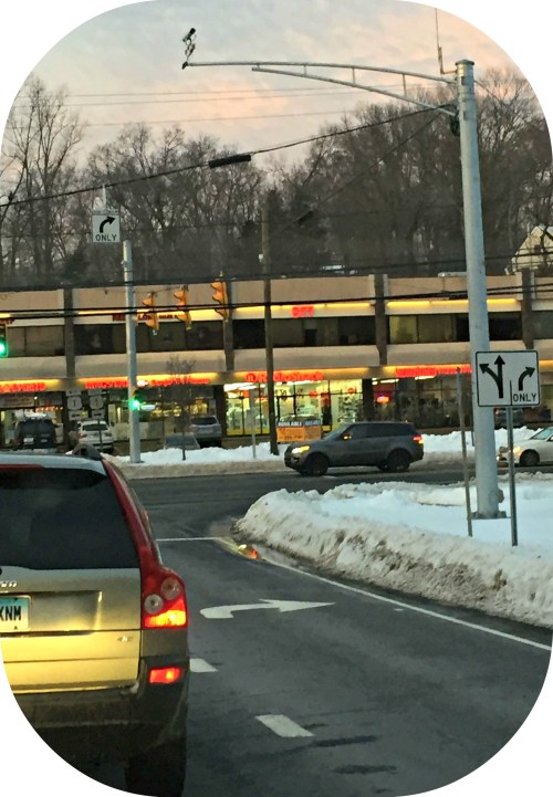
Alert — and only slightly suspicious — JP Vellotti recently noticed an interesting sight at the Sherwood Island Connector’s Post Road traffic light.

His passenger snapped a photo.

Sherwood Island Connector 1

JP writes:

The lights are new. It looks like a camera has been added too.

Who sees the feed? The police? Or maybe the state police, because this is a state road? Or News 12 for traffic? Or….

And how do cameras get approved, anyhow?

I’m not adversely against these. I’m just curious, having never seen a public notice about their installation. After all, if you’re recording the public, they should at least have the right to know.

What do you think? All “06880” readers — no matter where you fall on the civil liberties/police state spectrum — are invited to weigh in. Just click “Comments” below (and please use your full, real name!).