Tag Archives: Route 136

“Confusing Intersection” Sequel: Previous Plans

The state Department of Transportation’s announcement of possible work on the Route 136/Route 57 intersection — where Main Street, Weston Road and Easton Road meet in a confusing number of ways — is welcome news.

But it’s not the first plan.

Nor is it the second. Or even the third, fourth, fifth, sixth or seventh.

Former 2nd Selectman Avi Kaner sends along a slew of previous solutions to the confounding confluence. All were prepared by ConnDOT, and discussed with town officials between 2004 and 2006.

Here they are. Click on or hover over each image to enalrge.

One envisioned 3 small roundabouts:

Another showed one large rotary:

Five others involved some combination of road widening, adding turning lanes, and eliminating or modifying the center island:

As the saying goes: Whatever goes around, comes around.

Or, in the case of the roads near Exit 42, whatever goes around may crash into whatever else goes around, unless everyone going around pays close attention.

“Most Confusing Intersection” Improvement Plan Begins

Westporters learn to carefully navigate it. Visitors coming off Merritt Parkway Exit 42 are completely flummoxed by it.

At last — after decades of confusion — the Route 57 (Main Street)/Route 136 (Easton Road and Weston Road) cluster**** may get some improvement.

The state Department of Transportation has designed a plan. They’ll discuss it in a virtual public information program this Thursday (June 9, 7 p.m.), with a presentation followed by a question-and-answer session.

The meeting will be recorded. To access the meeting, provide comments or ask questions, click here (then scroll down to “Live Event Links”).

The plan includes replacing the existing flashing light with a full traffic signal, and widening the road.

The state Department of Transportation plan. Click on or hover over to enlarge.

Right-of-way impacts could include partial land acquisitions and easements.

The project is in the early stages of concept development. No funding or schedule has been identified. The public meeting is to discuss feasibility and solicit feedback.


BREAKING NEWS: Cribari Bridge Solution May Be At Hand

For years, the state Department of Transportation has pushed for a major renovation of the William Cribari (aka Bridge Street) Bridge.

For just as long, Westporters and town officials have pushed back. They fear that modernizing and widening the 2-lane span over the Saugatuck River would draw traffic — including 18-wheelers — off I-95, whenever there is an accident or delay on the nearby highway.

A solution appears to have been found.

And it’s a creative one.

The William Cribari (Bridge Street) Bridge. (Photo/Fred Cantor)

According to State Representative Jonathan Steinberg, the DOT is prepared to reroute Route 136. Right now, 136 includes North and South Compo Roads, and Bridge Street, through Saugatuck and on out to Saugatuck Avenue headed toward Norwalk.

Under the new plan, Route 136 would join the Post Road (also US1) at the North Compo intersection. It would head over the Ruth Steinkraus Cohen Bridge downtown, then go south on Riverside Avenue (also known as Route 33), and on toward Saugatuck Avenue.

Thus, the Cribari Bridge would no longer be a state road.

DOT has agreed to do repair work on the bridge — but not a major renovation.

When repairs are finished, DOT would hand the bridge over to the town. Westport would own it — and be responsible for ongoing and future maintenance.

The bridge and environs would no longer be Route 136.

The plan was described to a bipartisan group of state legislators from the area — Steinberg, State Senators Toni Boucher and Tony Hwang, and State Representative Gail Lavielle — by state DOT officials, including commissioner James Redeker. DOT wanted the legislators’ input, before presenting it to 1st selectman Jim Marpe.

[NOTE: An earlier version of this story described — based on a source — the meeting as a “negotiation.” It was an informational meeting only.]

“It’s not cost-free to the town,” Steinberg admits. “But once in a while we come up with creative solutions that work for everyone.”

He gives credit to the DOT. “If they weren’t on board, we’d still be battling this out,” Steinberg says.

Marpe notes, “The concept has just been presented to me. I’m working with my staff to understand the short-term and long-term implications — including finances and public safety — to the proposal. It’s certainly an alternative that needs to be seriously considered.”

The Bridge Always Wins

It’s a toss-up where this happens more: Saugatuck Avenue or South Compo.

Both places are crossed by railroad bridges.

Both places have prominent “low bridge” signs, with heights prominently posted.

Both places are the scenes of frequent accidents, when truck drivers don’t see the signs. Or don’t believe them. Or think they can squeeze through anyway.

Alert “06880” reader Adam Stolpen captured this afternoon’s accident, by the train station. Check out the message on the side of the truck!

Low bridge accident - Route 136 Westport

Be careful out there.

A $1 Million Realignment On Route 136

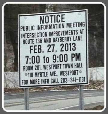
The other day, signs were quietly posted near the intersection of Bayberry Lane and Easton Road (Route 136).

They announced a meeting for Wednesday, February 27 (7 p.m., Room 201, Town Hall).

Bayberry Lane/Route 136 sign

A nearby resident did some digging. She found a report, issued by the South Western Regional Planning Agency. To her surprise — and most Westporters’, I imagine — the tough, well-traveled intersection has already been extensively (and expensively) studied.

SWRPA’s engineering consultants — Milone & MacBroom — have come up with 4 alternatives.

Two are near-term:

  1. Realignment of 136 with Bayberry Lane, and installation of 3 stop signs ($922,000).
  2. Construction of a roundabout on 136, with a center “vegetated island’ ($973,000).

Two are long-term:

  1. Realignment of the intersection, making it perpendicular (think Post Road/Compo Road North and South), rather than the current  Bayberry Lane Extension “jog” (think Post Road/Trader Joe’s/CVS parking lots — though with stop signs, not lights) ($1.22 million)
  2. Realignment of the intersection as above, including a roundabout ($1.35 million).

SWRPA prefers the roundabout alternatives.

Near-term alternative #1, showing placement of 3 stop signs. (Courtesy of Milone & MacBroom)

Near-term alternative #1, showing placement of 3 stop signs. (Courtesy of Milone & MacBroom)

There are 2 challenges to realigning the road. One is the house at 300 Bayberry Lane, which apparently would have its front yard cut diagonally in half. The other is wetlands on the northwest corner of Bayberry and 136.

A traffic light is not an option. It’s a state road, and Connecticut tries to keep lights to a minimum.

Residents have long complained of speeders on 136 — especially during rush hour. (Many drivers use it to avoid the Merritt Parkway “no exit zone” between 44 and 42.) Most cars at least double the 20 mph sign displayed at the Bayberry Road curve.

Meanwhile, White Birch — which turns into Bayberry Lane at the Westport line — is a main thoroughfare for Weston residents hurrying south.

Long-term alternative #2. You can see the outline of the roundabout in the center, and the new entrance to Bayberry Lane Extension just north of it. (Courtesy of Milone & MacBroom)

Long-term alternative #2. You can see the outline of the roundabout in the center, and the new entrance to Bayberry Lane Extension just northwest of it. (Courtesy of Milone & MacBroom)

SWRPA’s realignment solutions are very expensive. Area residents — concerned about both traffic and cost — wonder why simple stop signs (with other signs warning of the stop sign) can’t do the trick. Cutting back trees, to improve sightlines, would also help.

All of those issues will be discussed on February 27 at Town Hall — just a few minutes down Easton Road, from Bayberry Lane.

Depending, of course, on traffic.

(Click here for SWRPA’s intersection study. Click here for SWRPA’s final study presentation.)